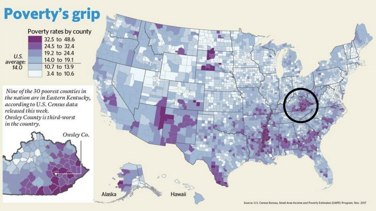
Poverty: According to the statistics conducted by Appalachian Research Commission, one out of every three Appalachians suffered from poverty; their average income was 23 percent lower than the average level of American per capita income. McCreary County is located in the Daniel Boone National Forest in southeastern Kentucky along the Tennessee state border. The only county nationwide where most households earn less than $20,000 a year, McCreary is the poorest county in both Kentucky and the United States. [Jan 25, 2019]

Climate: Summer days are typically sunny warm and humid. Most areas of the region receive more than 60 percent of available sunshine during summer. The average daily high temperature for July is about 85° F.
Terrain: A glaciated mountainous terrain with thousands of valleys, “hollows,” creeks, and rivers, Kentucky’s highest point is Black Mountain in Harlan County, 4,145 feet (1,264 meters) above sea level.
Natural Resources: water, forestry products, coal, oil, natural gas, and various other minerals.
Location: The southeastern region of the state of Kentucky (bordering with the states of Virginia and Tennessee). Kentucky is located in the south-central United States along the west side of the Appalachian Mountains, Kentucky ranks 37th in land size, with 39,732 square miles (102,907 square kilometers). The Commonwealth is bordered by seven states: Indiana, Ohio, West Virginia, Virginia, Tennessee, Missouri, and Illinois.